Chania, Crete: history, architecture and the memory of a port city
- Local name
- Χανιά · Chania · Hania
- Type
- Historic city and harbour
- Continent
- Europe
- Country
- Greece
- Region
- Crete
- Regional unit
- Chania
- Location
- Northwestern coast of Crete, Cretan Sea
- Historical names
- Kydonia; La Canea
- Historical periods
- Bronze Age; Greek, Roman, Byzantine, Venetian, Ottoman and modern periods
- UNESCO
- Kydonia only: Minoan Palatial Centres, 2025; not the entire Old Town · UNESCO
- Date
- August 2021
- Photographer
- Héctor Godes
- Published
- August 12, 2025
- Reviewed
- November 7, 2026
- Coordinates
- 35.5138, 24.0180
- More
- Wikipedia
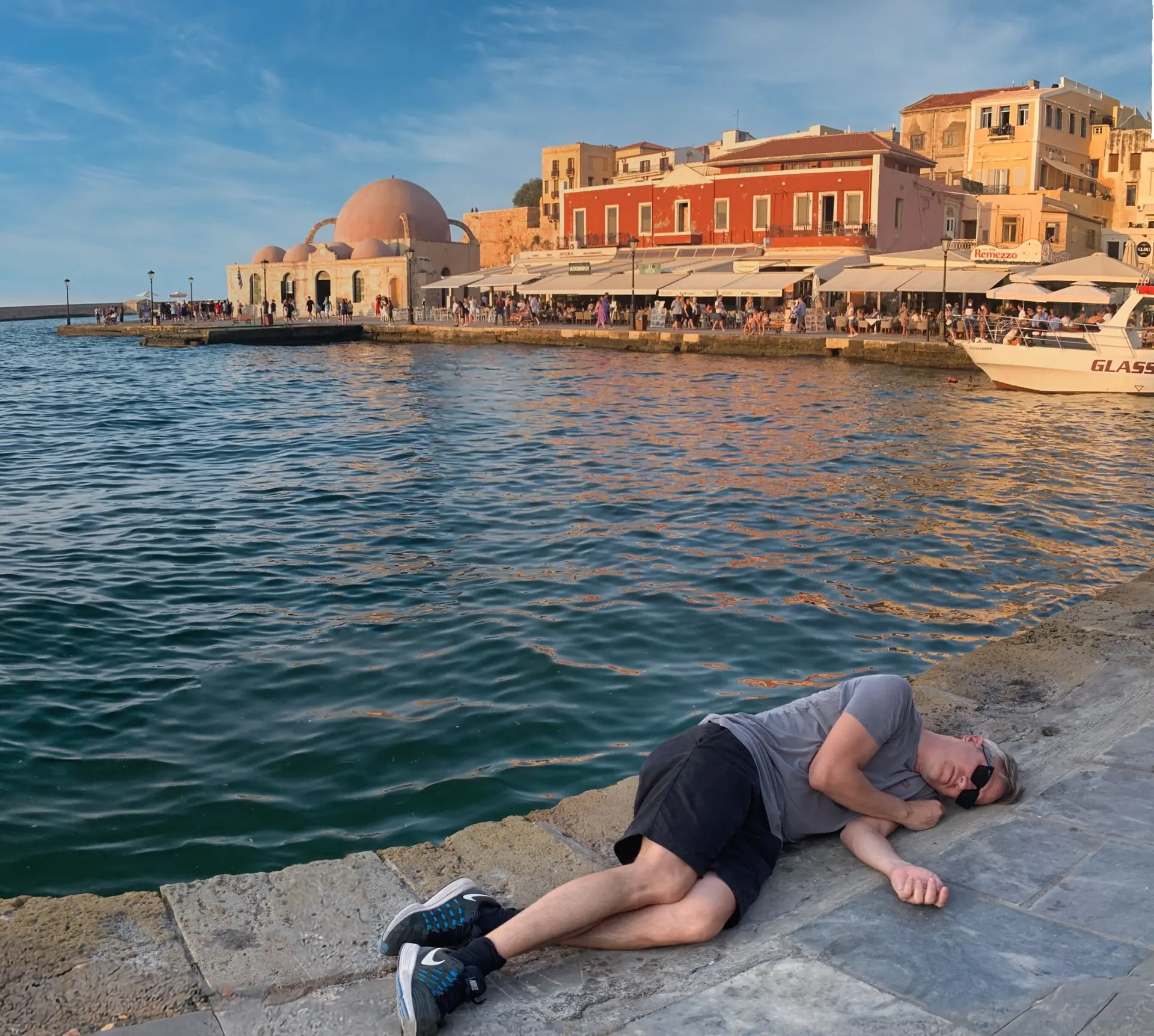
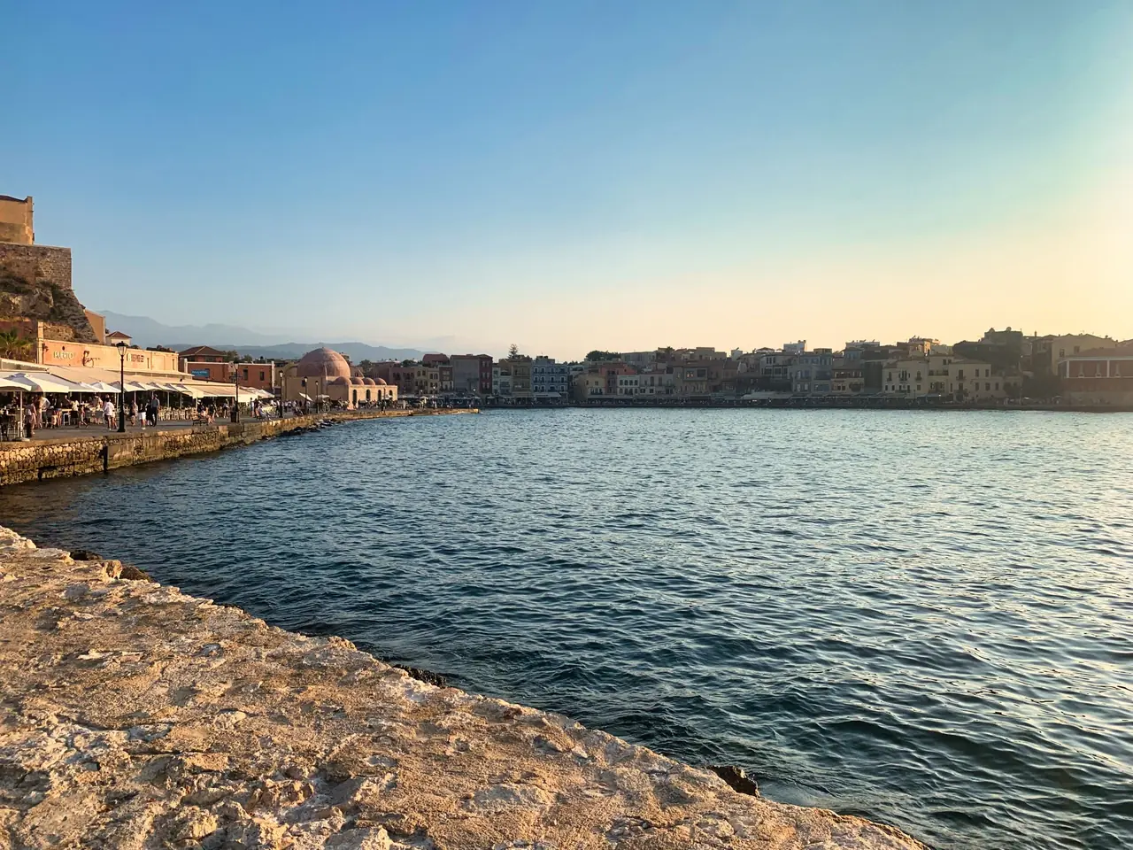
On Chania’s waterfront, an Ottoman mosque faces a lighthouse built on a Venetian base. Behind the harbour cafés, streets rise towards Kastelli, where the remains of ancient Kydonia still emerge beneath the inhabited city. History does not occupy a separate enclosure here: it lies in the relationship between the water, the defences, the houses and the places of worship.
Chania, on Crete’s northwestern coast, brings centuries of Mediterranean history into a remarkably compact space. Calling it a picturesque mixture of cultures, however, leaves out much of what makes it significant. Its buildings speak of trade and navigation, conquest, religious conversion and population displacement. They also reveal the choices involved in preserving a city without turning it into a stage set.
Where is Chania, and why does its location matter?
Chania —Χανιά in Greek, also written Hania and historically known as La Canea— lies in the west of Greece’s largest island. Its coast opens onto the Cretan Sea, within the maritime networks of the eastern Mediterranean. This position helps explain both the persistence of settlement and the interest of the powers that contested it.
A harbour is more than a shelter for ships. It requires warehouses, workshops, approaches and defences; it brings together goods, labour and authority. These functions organise Chania’s historic landscape. Kastelli rises beside the water; the arsenals follow the former naval waterfront; the breakwater and fortifications define the maritime entrance. Reading these features together explains why the architecture took particular forms.
From Kydonia to La Canea: history beneath the streets
The Minoan city and the continuity of settlement
Long before the Venetian harbour existed, this was the site of Kydonia, one of the centres of Minoan Crete. Excavations at Kastelli have uncovered structures, pottery, seals and administrative documents that help establish its importance in the Bronze Age. This does not mean assigning a palatial function to every ancient wall: interpretation depends on archaeological context and the relationship between discoveries.
Kydonia was significant during the Neopalatial period, approximately 1700–1450 BC. Research here faces a particular obstacle: much of the evidence remains beneath later buildings. Unlike an isolated archaeological site, excavation must coexist with homes, streets and services. The visible remains represent only part of a much larger settlement.S2
Occupation continued through later periods. Kydonia became a city of Greek Crete and entered the Roman world in the first century BC. Continuity of place does not mean that its institutions or inhabitants always remained the same. It means that successive societies continued to find reasons to settle on this coastal site and reuse spaces inherited from their predecessors.
Byzantium, the Cretan emirate and Venetian rule
Crete belonged to the Eastern Roman world, usually called Byzantine. In the ninth century it came under an emirate established by Muslims from al-Andalus; the Byzantine conquest of 961 changed its political framework again. These episodes place local history within the struggle for eastern Mediterranean routes.
After the Fourth Crusade, Venice consolidated its control of the island. In Chania, Venetian colonisation in 1252 began a decisive phase in the organisation of the city. La Canea joined a maritime network that depended on secure ports of call, supplies and the movement of goods. Religious and civic construction accompanied sustained investment in fortifications and harbour infrastructure.
The Venetian legacy remains visible, but Chania’s chronology must be distinguished from that of Crete as a whole. The city fell to the Ottomans in 1645; Candia, modern Heraklion, held out until 1669. Confusing those dates incorrectly extends Venetian rule in Chania.S1
Ottoman conquest and the changing religious landscape
Conquest did not erase the existing city. It altered its uses, institutions and sacred spaces. Some Catholic churches became mosques; minarets were introduced and earlier buildings adapted. Houses changed too, accommodating other ways of living. Assigning each building to a single culture can therefore conceal its most revealing history: the transformations it underwent.
The presence of Christian, Muslim and Jewish communities should not be presented as uninterrupted harmony. Everyday relationships and exchanges existed alongside inequalities, conflict and rupture. Neighbourhood names preserve aspects of this social geography, but they do not constitute a map of permanently fixed boundaries.
From the Cretan State to union with Greece
Nineteenth-century uprisings and intervention by the European powers led to the autonomous Cretan State in 1898. Chania became its capital and played a central part in the island’s political transition. Eleftherios Venizelos connects this history with the development of modern Greece.
Formal union with Greece was celebrated on 1 December 1913, with the raising of the Greek flag at Firka Fortress. A structure designed for maritime defence thus became a setting for political remembrance. In May 1941, bombing and the Battle of Crete brought another profound rupture. Today’s city incorporates both older survivals and twentieth-century reconstruction.
The Venetian harbour: infrastructure before a postcard
Trade, shelter and control of the sea
The harbour’s configuration reflects successive interventions, particularly under Venetian rule. The breakwater shelters the basin while the defences oversee the entrance. The built waterfront connects the water to spaces of exchange and repair. What now appears visually harmonious developed from practical requirements.
Treating the harbour as a system makes it possible to relate its monuments. The lighthouse marks the approach; fortifications protect it; arsenals maintain the vessels supporting trade and naval power. No single feature fully explains the importance of the whole.
The Neoria: the architecture of naval work
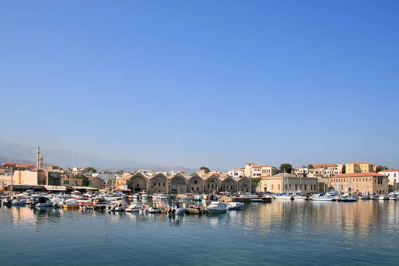
The Venetian arsenals, or Neoria, preserve the scale of an activity now less apparent on the waterfront. Their long, vaulted halls provided space for ship repair and maintenance. Repetition was not an ornamental gesture: it responded to the technical organisation of work.
The municipal tourism bureau records the completion of the first two arsenals in 1526 and seventeen in the principal complex by the end of the sixteenth century. It distinguishes the seven surviving adjoining halls, the Grand Arsenal and structures in the Moro complex. That distinction prevents the surviving remains from being described as one entirely intact building.S3
Later reuse shows how conservation can depend on finding new functions for structures whose original activity has disappeared. The vaults continue to explain the naval past even when their interiors no longer serve ships.

Firka and the lighthouse: defence, navigation and remembrance
Firka stands at the western end of the harbour entrance. Its location makes its purpose intelligible without imagining an isolated fortress: it belonged to a defensive system controlling access from the sea. Its association with the 1913 ceremony added a national meaning to a structure of Venetian origin.
The lighthouse needs a further distinction. Municipal documentation dates the Venetian construction to around 1595–1601 and records nineteenth-century transformation during Egyptian administration within the Ottoman framework. Its present appearance cannot be attributed wholly to Venice.S4
The separation of the two shores makes the entrance legible as a watched and signalled space. Fortress and lighthouse meet two different needs of the same maritime city: controlling entry and assisting navigation.
The Old Town: neighbourhoods that preserve change
Kastelli, the elevated centre
Kastelli concentrates much of Chania’s archaeological depth. Its raised position beside the harbour favoured defensive and administrative functions at different times. Bronze Age remains coexist with buildings and gaps belonging to subsequent periods.
The neighbourhood challenges the assumption that the oldest element must be the most visible. Sometimes the evidence most important to understanding the city lies beneath street level. Conservation then involves relating excavated remains to inhabited surroundings without treating either as merely an obstacle to the other.
Splantzia and the Church of Agios Nikolaos
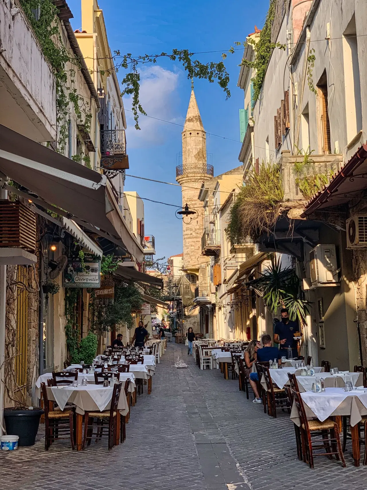
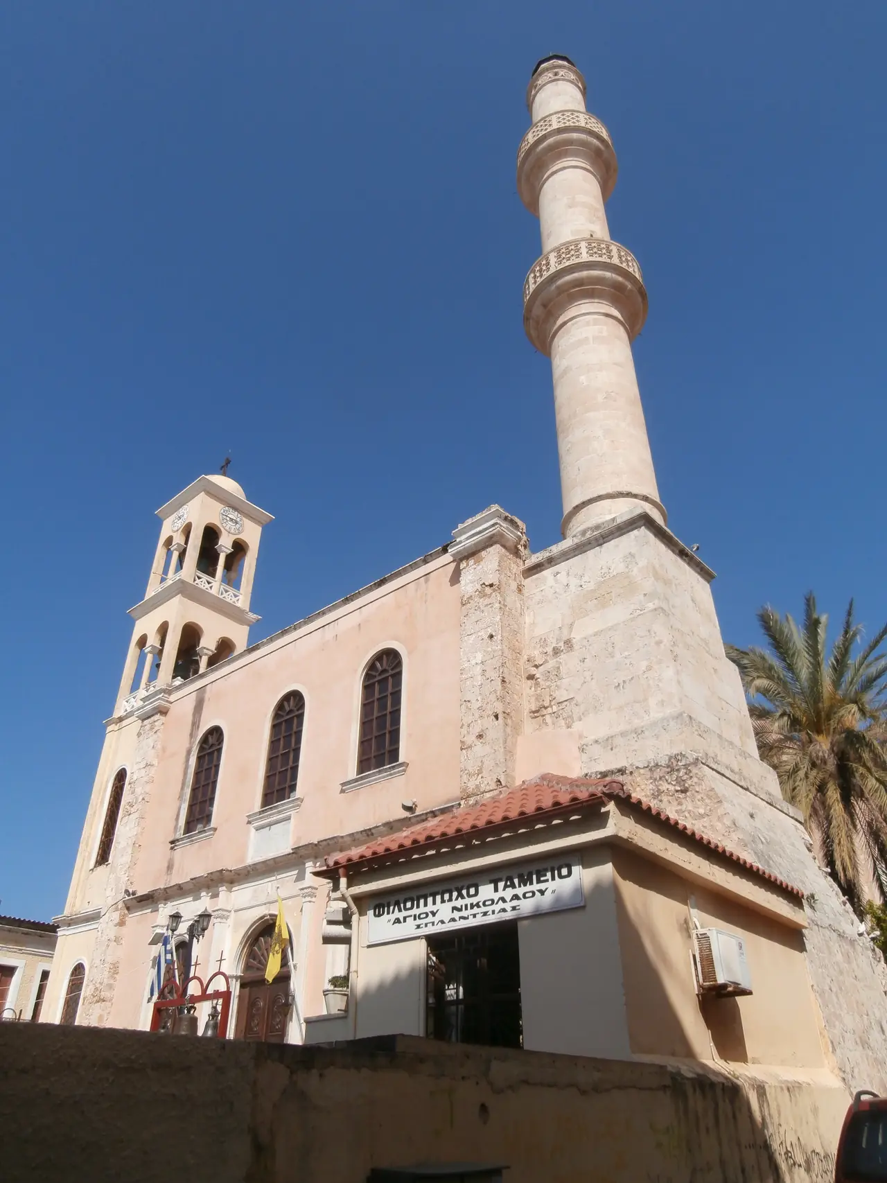
Splantzia shows how a building can retain evidence of more than one religious tradition. Agios Nikolaos belonged to a Dominican monastery in Venetian times. Under Ottoman rule it became a mosque; it later passed into Orthodox use while retaining its minaret.
A bell tower and minaret in the same complex do not summarise a history of continuous tolerance. They document changes of authority, appropriation and reuse. What is remarkable is that these episodes remain readable in the architecture rather than surviving only in written explanations.

Topanas and the streets of an inhabited city
To the west, Topanas preserves narrow streets, stone doorways and buildings modified during successive periods. Its name draws on Ottoman terminology associated with artillery. Rather than a neighbourhood frozen in one era, it is a collection of structures that changed ownership, function and appearance.
Side streets offer a scale missing from the waterfront. Balconies, plants, openings and façade alterations help explain domestic architecture. A historic city is shaped by these ordinary solutions as well as its monuments.
Mosques and synagogues: what buildings remember
Küçük Hasan Mosque beside the water
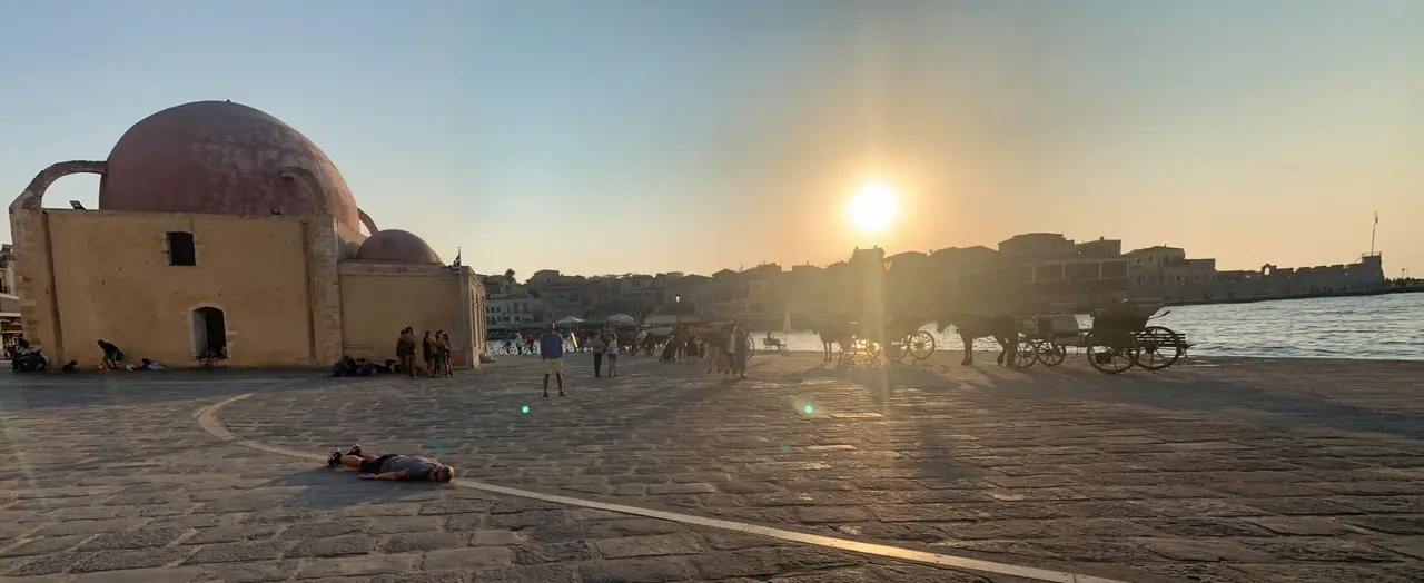
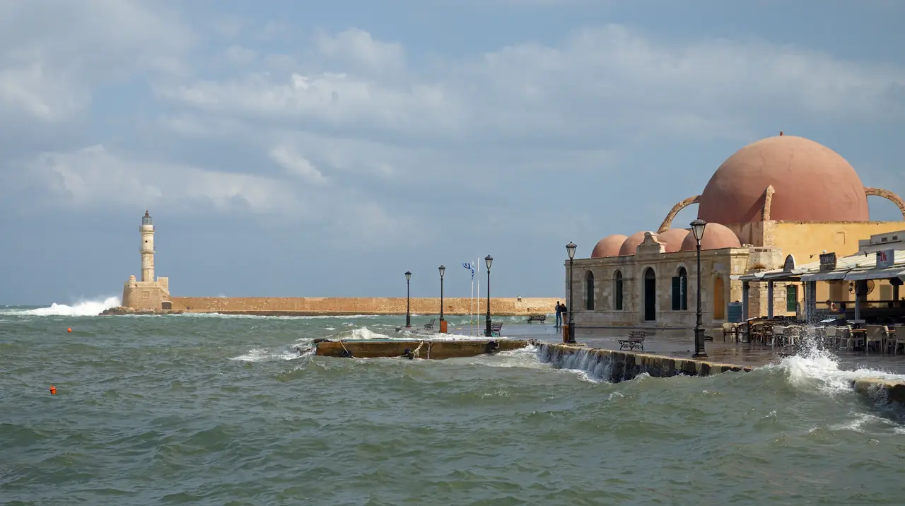
Küçük Hasan Mosque, also known as the Mosque of the Janissaries or Giali Tzamisi, is one of the harbour’s most recognisable buildings. Its domes introduce a different architectural form among the waterfront façades. Its construction belongs to the establishment of Ottoman power in the seventeenth century.
Seeing it alongside the lighthouse and the waterfront explains why the city’s history cannot be divided into separate enclosures for different civilisations. Buildings from earlier periods remained through later ones, acquired new neighbours and changed meaning. The mosque retains its heritage significance even though it no longer performs its original religious function.

Evraiki and the memory of Etz Hayyim
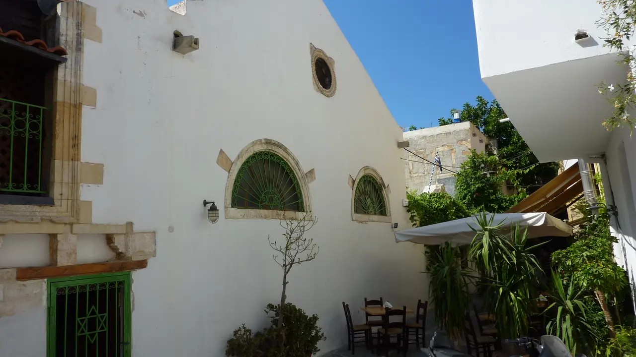
The Jewish quarter, known as Evraiki or Ovraiki, is essential to understanding the city. Etz Hayyim Synagogue preserves the memory of a community whose history cannot be reduced to a decorative contribution to local diversity.
During the German occupation, Crete’s Jews were arrested and deported. In June 1944, those held aboard the Tanais died when the ship was sunk. The loss of the community created a human rupture that the survival of the building alone could not repair.
Etz Hayyim had been a Venetian Catholic church before becoming a synagogue. After decades of abandonment, restoration culminated in its rededication in 1999, following the initiative of Nikos Stavroulakis. Its recovery brought together material conservation, research and remembrance. Preserving a place of worship also means explaining who used it and why that continuity was broken.S5

Chania today: preserving a city that keeps changing
The contemporary Old Town results from losses, repairs and decisions about building use. Rehabilitation can rescue a deteriorating house while changing the relationship between housing, commerce and public space. Heritage value depends on more than preserving façades: the centre must also remain a habitable part of the city.
The archaeological museum, housed in Chalepa since 2022, complements the streets with objects from western Crete’s history. City and collections offer different approaches: one explains the transformation of spaces; the others help reconstruct periods whose buildings survive only in fragments. S7
Frequently asked questions about Chania
Are Chania and La Canea the same city?
Yes. Chania is the usual transliteration of Χανιά; La Canea is a historical Western name linked to Venetian usage. Hania is another common spelling.
What is most significant about Chania’s heritage?
The relationship between ancient Kydonia, the fortified town, the harbour and the buildings of different communities. Understanding these connections reveals more than considering each monument separately.
Is the lighthouse Venetian or Egyptian?
It has Venetian origins and important nineteenth-century modifications during Egyptian administration. Both phases are needed to explain its appearance.
Is all of Chania a World Heritage Site?
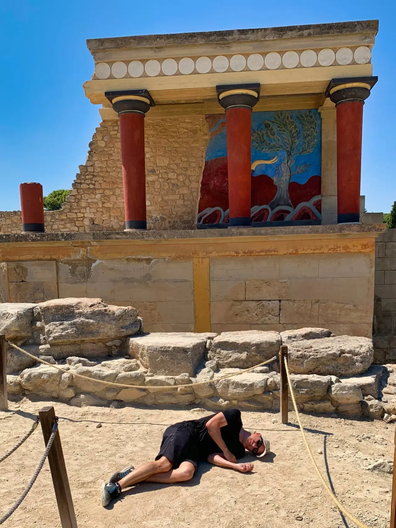
No. The 2025 inscription includes the archaeological component of Kydonia within a Minoan property comprising six Cretan sites. It is not an inscription of the Old Town as a whole.
When did Crete unite with Greece?
Formal union was celebrated on 1 December 1913. In Chania, the ceremony at Firka connected the harbour with this political change.
Sources and documentation
- S1 Visit Chania — A Brief History.
- S2 Hellenic Heritage — Kydonia: The Minoan palace of Chania.
- S3 Chania Tourism Bureau — Venetian Shipyards (Neoria).
- S4 Chania History / Municipal Library — The Lighthouse.
- S5 Etz Hayyim Synagogue — The History of Etz Hayyim.
- S6 UNESCO — Minoan Palatial Centres: property and component maps.
- S7 Hellenic Heritage — Archaeological Museum of Chania.
More in Greece
 UNESCO WH